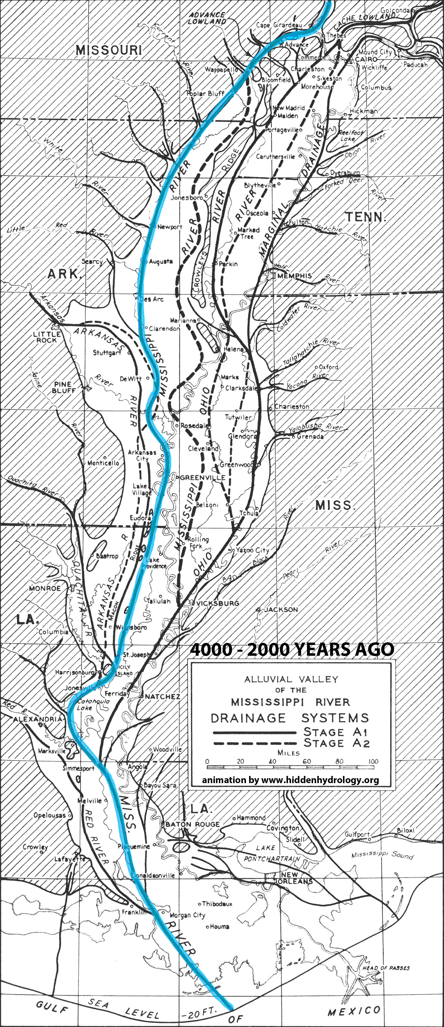
From the recent post, Indeterminate Rivers the Geological Investigation of the Alluvial Valley of the Lower Mississippi River by Harold N. Fisk offers a wealth of information on landscape change. When I first saw the series of maps the idea of showing the shifting path of the river came to mind – and I envision a much more intensive and animated idea could be applied to the color map series (from the original post) to illuminate not just the static traces but the actions of this hidden hydrology over time.
The simple animation below is based on the maps in the report that discuss the formation of the valley and the current configuration of the meanders. For reference, this map isn’t an attempt to make conclusions, but to activate some of the data represented in 2-D format in the report – showing the breadth of change of the main path of the Mississippi over the course of 4000 years of change.
More explanation of the specifics found at the page ‘Mississippi River Change’.