
The typical news story from Los Angeles that often emerges concerning rivers tends to focus on the LA River and it’s future and fate. Countless stories of the latest master plans or rehabilitation efforts, Army Corps efforts, or just plain ire at the fact that Frank Gehry was involved have been flying around for years. One of my favorite takes is documented in the fantastic 2008 publication ‘The Infrastructural City‘, which breaks down LA into a number of systems including a good amount of focus on the River. And while no one would dispute the importance of the river to the city (and to countless movie chase scenes) there is a broad and complex hydrology and at work in the City of Los Angeles.
The folks at LA Creak Freak offer a slightly different and broader take, and while they do offer plenty of discussion on the LA River, they explore some of the other tangents of hidden hydrology. As mentioned in their About summary the site is both “… a way to share information about LA’s historical ecology – the rivers and streams that were once here – and to update people on relevant watery news and events with a mostly local focus…” and “…that we believe our rivers and creeks are vital to our communities and our planet. Though degraded and forgotten, they’re worth saving.” This information and activism role is similar in nature to much of my inspirations, so it was interesting to dig into their site. The main players are landscape architect Jessica Hall and Joe Linton, an artist, author and activist with a long involvement in the community. The site links to maps, stories, resources, and some transcribed interviews as well. It’s somewhat free-form, with a few helpful summaries like ‘getting started‘ and ‘recommendations‘ but like many sites, is chock full of place specific info that you just have to spend time digging in to.
Some of the links led to a map from the Rumsey collection of the topography of Los Angeles from 1880 by William Hammond Hall shows another “Beautiful hand drawn map of the Los Angles-San Bernardino Basin. Pen-and-ink and pencil. Relief shown by hachures. It appears to be a base map on a scale of two miles to an inch, probably preliminary (several of Hall’s notations on the edges indicate corrections needed to the topography) and earlier than the 1888 Report titled “Irrigation in California” that had 15 maps that may have been derived from this map. It may also have served as the base for “Drainage area map to accompany report on irrigation and water supply in California” by Wm. Ham. Hall, State Engineer. (188-?). Hall was a famous engineer who was the first state engineer and was responsible for many of the early state water projects (see California Water Atlas). This map does not have any names drawn in except for a few towns, rivers, or railroads lightly penciled in. All the land divisions and city plats are indicated, with mountains, rivers, railroads, roads, arroyos and shorelines shown.”

A link to a map of the North Branch of the Arroyo Seco offers some commentary on the mapping: “I am fascinated by the messiness of the historical landscape before it was flattened and filled, with water confined to neatly linear paths. There are so many notations mapmakers used to depict the ways water manifested in the historical landscape. William Hammond Hall’s maps go beyond mere notation, into the realm of artistic representation. In contrast, USGS maps of contemporary Los Angeles use a limited and inflexible set of icons to depict water: blue lines for waterways (thin or thick, solid or dashed), and blue amoebas for lakes. Does the simplicity of these icons reflect what we’ve done to our surface water; or has what we’ve done to our surface water reflect our simplistic cultural idea about how a water body is supposed to look like and behave?”

While the USGS maps of modern day (or at least 1975 from above) may have evolved be more more generic, but the old ones had some beauty, as shown here in a map from 1896 snapped from the great USGS Historical Topographic Map Explorer.

 I love the scale of the monumentally awesome Historical Creek & Wetlands Map of the lower Lost Angeles River and environs map below shows a range of buried creeks, sandy washes, historic wetlands, as well as existing creeks, concrete channels and drains (key to left) from around 1902. Not sure who was the author of this map although the copyright shows 2003 from North East Trees. The original orientation of the LA River and tributaries is interesting to see, along with the other hydrologic elements and topography. There are a number of other excerpt maps from areas around LA as well.

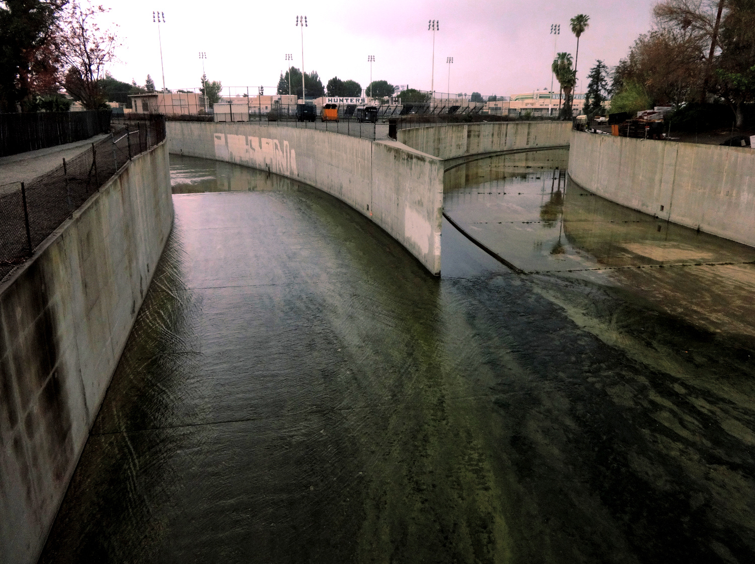
Obviously the LA River is the major drainage, but there are plenty of tributaries and other side drainage weaving through the urban realm. A Google map created by the LA Creek Freak folks provides a bit more context beyond the main LA River channel, showing historic drainages woven through the City such as Ballona Creek much of which is buried and/or channelized.

A great example of online resource in that same basin is the Ballona Historical Ecology web site, an interactive exploration created by multiple sources including the San Francisco Estuary Institute, Southern California Coastal Water Research Project, and the Santa Monica Bay Foundation, along with CSU Northridge, CSU Chico, and USC. For more information you can also download a report for the project here.

Another link to a map show at the LA Central Library called L.A. Unfolded (awesome idea), which led to some more historical maps shows this gem from the Online Archive of California for a Map of the City of Los Angeles from 1884.

A side trip to Jane Tsong’s Myriad Unnamed Streams is a worthy diversion, with stories and maps focusing on Northeast Los Angeles. Various snippets of water history like “Where the Creeks Ran Underground” offer some place specific notes, maps and history for a small segment of LA around Eagle Rock Creek. This series of key maps shows the area with streams only.

And with the overlay with modern sewer system, “Street map showing storm drains/1888 water courses as mapped by State Engineer William Hammond Hall, overlaid onto modern topographical data. Street, stormdrain and topographical data: Bureau of Engineering.”

Also worth checking out is a Curbed LA story “25 Photos of the Los Angeles River Before It Was Paved in 1938″ shows a different, softer side to the river, such as it meandering near Boyle Heights in the 1880s:

And from 1931, “The then-new Fourth Street Bridge” showing a natural river bed and although channelized, softer edges to the river.

This one, from 1938, indicates the plans for channelization: “Shown is an artist’s sketch which graphically portrays the system of dams, underground storage basins, etc., that were set up by the Los Angeles County engineers to prevent floods and to conserve hitherto wasted rain water for domestic purposes.”

 The end came after floods in spring of 1938, as described in a book The Los Angeles River: Its Life, Death, and Possible Rebirth: (Blake “The first Los Angeles River projects paid for by the federal government and built under the direction of the U.S. Army Corps of Engineers were completed a few months after the flood. Work was finished in October 1938 on three projects to lower the river’s bed twenty feet, widen its channel and pave its banks for a little over four miles upstream from Elysian Park. Three months later, construction was completed on the first segment of what would eventually be a continuous trapezoidal concrete channel to carry the river from Elysian Park to Long Beach.”
Hey Jason, thanks for the nice mention and covering our blog! Great to meet (albeit digitally) a fellow creekfreak! Excited to dig into yours now, too.
Helping people see ground water and creeks / rivers and a holistic system is critical; thank you for this piece.