
SNAPSHOT: Animation based on the Geological Investigation of the Alluvial Valley of the Lower Mississippi River by Harold N. Fisk. For reference, this map isn’t an attempt to make conclusions, but to attempt to activate some of the data represented in 2-D format in the report. When I first saw the series of maps the idea of showing the shifting path of the river came to mind – and I envision a much more intensive and animated idea could be applied to the color map series (seen in the header) to illuminate not just the traces but the actions of this hidden hydrology over time.
Read the blog post from 01.03.16 – Indeterminate Rivers for more information about the project. report and maps. Scroll below the image for more information about the specific series of maps and click the map to launch in another window to see the entire image.
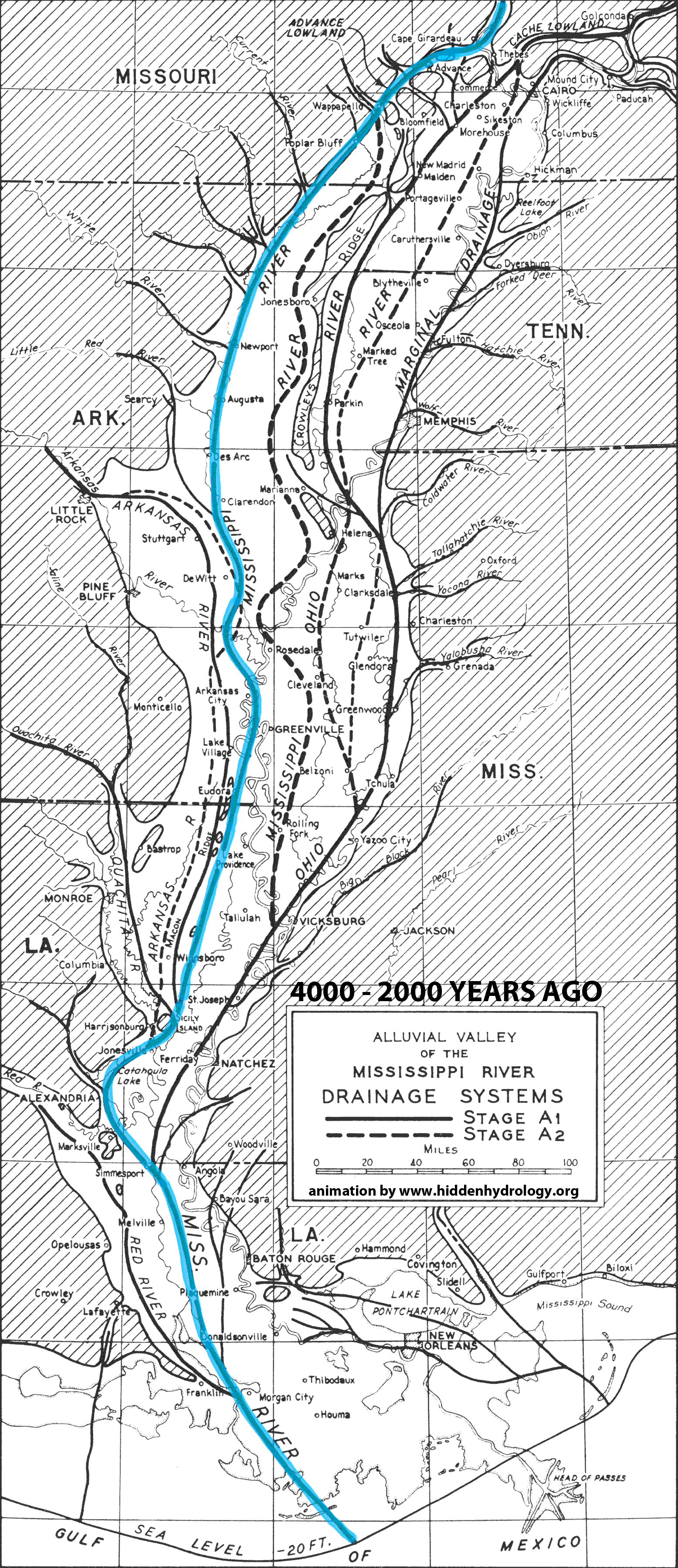
The maps shown above were taken from the Geological Investigation of the Alluvial Valley of the Lower Mississippi River – Part V: Recent Geological History (link here). The report outlines a series of Epochs that have changes the course of the Mississippi over the past 4,000 years. It’s not meant to be a specific chronology but to use the available report graphics to show significant changes within the Lower Mississippi Basin. I digitized the maps and rectified them, and created this 12-image animation I’m struck by the changes in the Ohio River as it connects to the Mississippi at different points from the east and northeast, the ability of the main river to traverse over 60 miles from the west side of the valley to the east, and the various configurations of the delta. Summary of map information is simplified for timeline, but the report page 37 – 45 explains the various evolution.
4,000 years to 2000 years (Valley Alluviation)
EPOCH OF RISING SEA LEVEL: Stage A1, A2
EPOCH OF STANDING SEA LEVEL: Stage A3, B1, B2, B3
ABANDONMENT OF THE WESTERN LOWLANDS: Stage C1, C2:
THE SUNFLOWER SYSTEM: Stage D
THE BREAKDOWN OF THE SUNFLOWER SYSTEM: Stages E-J
2,000 years to present (Evolution of the Present Meander Belt)
DRAINAGE: Stage 1 – 7
FINAL OCCUPATION OF WALNUT BAYOU SEGMENT: Stage 10
THE VICKSBURG DIVERSION: Stage 11
THE DONALDSON DIVERSION: Stage 12
THE BARATARIA SUBDELTA: Stage 15
In the report the final stages 17-20 are approximately from 1699 to the present, called the Balize Subdelta. Figures are not included but can assume some of the more recent mapping would show the modern river course – and also probably start to be influenced heavily by human influence.
The issue of mapping the delta is mentioned by Fisk: “Unfortunately, delta topography is extremely difficult to survey; consequently, old maps lack the accuracy and completeness necessary for critical comparison with present-day maps.”