
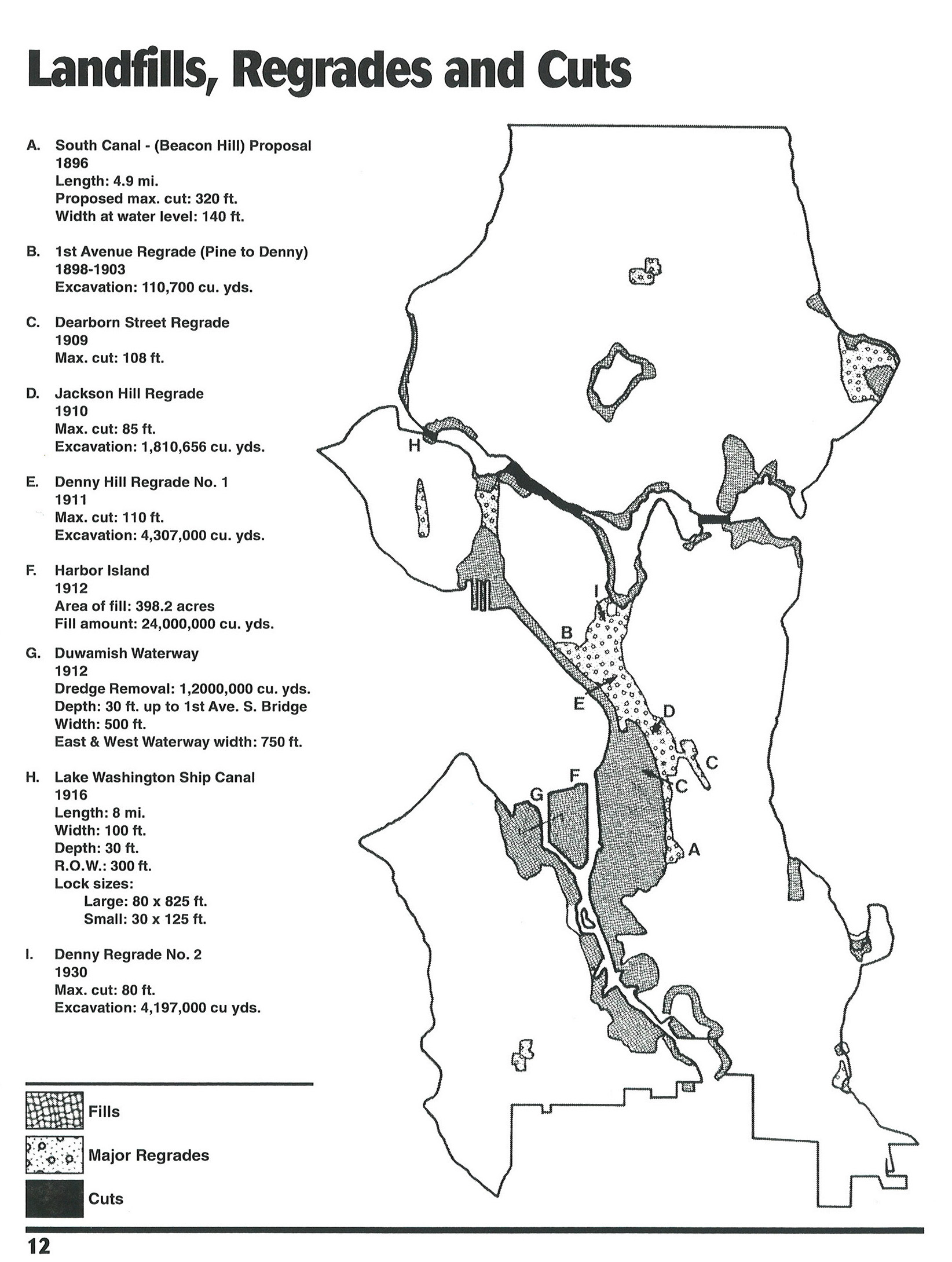
A quick one to show a map that captures the essence of the story of Seattle – this 1996 “Map of landfills, regrades, and cuts” outlines significant changes to the landscape of the city over the formative decades from 1896 to 1930. The source is the Seattle Municipal Archives, with a note of a source Seattle Engineering Department Digest, Special Commemorative Edition. A few interesting ones that aren’t labelled, such as the northernmost ‘Regrade’ which aligns in the vicinity of Northgate Mall and the wetlands around North Seattle College in the Thornton Creek drainage, and what I assume is also filling of the wetlands in the middle of Magnolia (just below the letter H). Also, while I get that there was some manipulation of Green Lake, I don’t think it’d be technically correct to refer to that as a fill, at least in the traditional sense of ‘making land’. It’s interesting to see these all captured in one figure. The impacts, of course, are well known.
HEADER: Denny Regrade – circa 1910, via Wikipedia entry “Regrading in Seattle”
\\ h/t to folks on the Reddit Seattle Group that linked to the map originally.