We live in an age where the impacts of climate change are seen daily. Data on global and local conditions is vital to our further understanding of adaptability and resilience both as protection from storms as well as mitigating longer term impacts. While understanding where we’re at in modern times is essential, comparing that to historical reference conditions connects threads from past to present and enlivens this discussion. Thus in the spirit of hidden hydrology and linkage to climate and rainfall, I was fascinated to learn about the book Climatology of the United States, And of the Temperate Latitudes of the North American Continent, authored by Lorin Blodget in 1857. This is interesting as it coincides with much of the development of Pacific Northwest cities in the mid 1850s so is a good indication of some predevelopment metrics, but more importantly is towards the beginning of the global Industrial Revolution (centered in London and radiating outwards), which led to rapid increase in development of industrial infrastructure and processes that created significant amounts of atmospheric CO2, which is arguably one of the biggest contributors to climate change.

This volume is 569 pages, packed full of info (and a massive PDF also).  Most interesting to me and the original link i found was the amazing maps (abbreviated viewer here of the maps from the publication if you don’t want to download the whole thing) covering the world and specifically covering the temperate landscape of the Northern Hemisphere, with a focus on North America.  In the introduction, some rationale for the project from Blodget.

I’m assumed he was referring to Alexander von Humboldt, but had missed the reference and probably would if he wouldn’t have mentioned it above.  After some digging I noticed a deft reference in  ‘The Humboldt Current: Nineteenth Century Exploration and the Roots of American Environmentalism’ (Aaron Sachs, 2007).  Sachs links the two, mentioning on page 25-26, “Almost all American scientists in the mid-to-late nineteenth century, no matter what subfields they waded into, considered themselves disciples of Humboldt. One such author, Lorin Blodget, inserted a quote from the master himself on the title page of his own magnum opus, Climatology of the United States, to make a kind of textual frontispiece.” 

The quote in small print on the front:

Like Humboldt’s work, the illustrations and summary visualizations of the phenomena he was describing, Climatology includes amazing illustrations (do yourself a favor and click the images in this post to enlarge them.  The banner image of global temperatures above in the banner, as well as the world spanning ‘Comparison of Precipitation for the Temperate Latitudes of the Northern Hemisphere’ is Humboldtian indeed:

The smaller diagrammatic maps also evoke Humboldt’s stratification by elevation, captured in Blodget’s ‘Profile of the Altitudes’ for both the Pacific Coast of North America and the West Coast of Europe are some simple info-graphics rich in information and easily accessible.

The main substance of the document is the maps, include temperature (isothermal) and precipitation (hyetal) maps.  There is a world view of both – as you’ve seen examples of above, but the focus is on North America, so each season is represented, along with an average annual.  Summer and Winter are shown below, the difference being hopefully obvious:

The legend describes the map info, including max. and min. ranges for temps.

And a close-up of the Pacific Northwest shows the level of detail – along with a glimpse at the base map, which is similar, mostly in how topography is represented, to the one well know in the region as the 1859 Map of the state of Oregon and Washington Territory.

We take a lot for granted the amount of data, A challenge of the process was to gather and assimilate diverse information from a variety of sources, due to the fact that there was no consensus on the measurement and documentation of either temperature and rainfall data.  Blodget spends a lot of time explaining the process, with a specific focus: “These references are deemed necessary to show that no part of the present work, whether supported by statistics and illustrators or not, was is the result of hasty or superficial discussion, and that all the steps of analytical investigation and detailed criticism required for such a purpose as that of constructing an approximate climatology, have been taken in advance.”

The rainfall maps are interesting as well showing in a variety of data, in shaded portions based on inches of rain.  The image for annual totals shows the wetness of the southeast United States and the Pacific Northwest.

Zooming into the Southeast US – we see the intensity of rain in the southern tip of Florida, along with the Mississippi Delta.  These are beautiful maps, considering they were done over 150 years ago, and the subtlety of shading and texture represented.

These are best represented in sequence (and i do love a good animation) so I did a quick overlay and made them step through seasons starting in Spring and sequencing through Summer, Autumn and Winter.  Note the Pacific Northwest wet winter / dry summer cycle, and the overall difference between the coasts/interior as well as West Coast / East Coast.  Somethings don’t change.  Click to enlarge to make it a bit more legible.

I’ve yet to dive fully into the text, but have some context in the maps, and a curiosity to see the data at this level of analysis overlaid with modern information on isothermals and hyetals to show changes, in average and seasonal temps, changes in rainfall, and related hydrology and changes in things like plant hardiness ranges.  Lots to unpack.  While looking at this, I did find an earlier reference by Blodget, a slim volume published in 1853 which also tackles climate in reference to it’s impact on Sanitary conditions in cities, delving into the connections between climate and public health – well, 164 years ago.

The visual nature of the 1857 publication is not to be dismissed. The publisher J.B. Lippencott & Co., acknowledges the rarity of a book of this era having the size of quality plates, and their goal to make this available to the public at a reasonable cost.  Such an interesting dilemma in our digital age, but one I’m glad for in terms of the production of this imagery as well as it’s preservation and archive.  Just think, all this could have been yours in 1857 for the price of five dollars.

The climate data today… priceless.
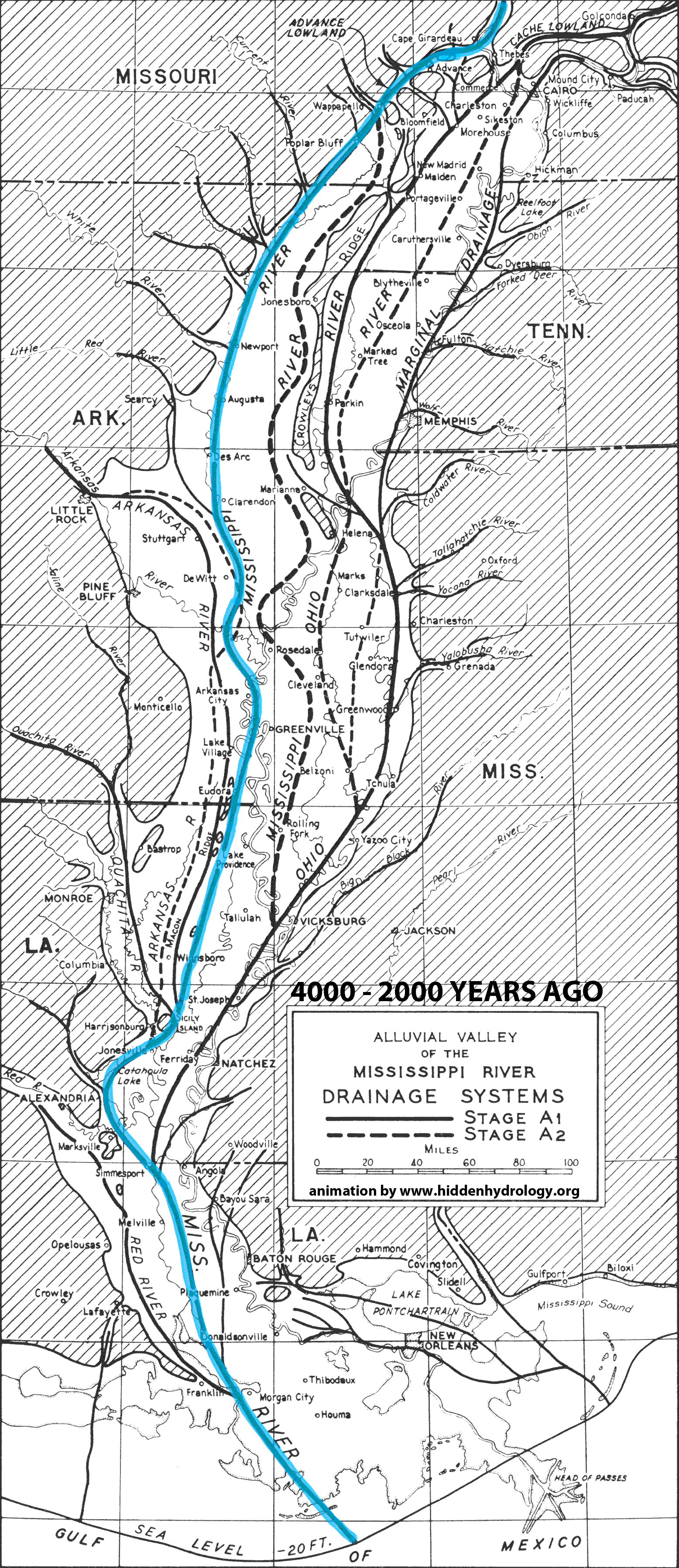
Map-making is an inherently iterative process.  Often finding an appropriate base layer is vital to providing a solid foundation for this process. In this spirit, I’ve been working on the digitization of the basic Public Land Survey System (PLSS), or the Cadastral Map series for both Portland and Seattle from the 1850s as base maps for the hidden hydrology studies of both cities.  This data, which is the most uniform and complete snapshot of the landscape of the west, is a great resource for the locations of historic streams and other features.  Because the use of the shared cartography of Townships with their corresponding Section grids, the PLSS maps provides a link to very accurately georeference the historic with the modern.  Prior to diving into some of this work, I thought it prudent to discuss the Public Lands maps themselves.

There’s plenty of history out there for those in the mood, and my plan isn’t a deep dive, but more of some context.  A good starting place is ‘The National Map’ page by the USGS on the subject of the PLSS, and a brief history page from the BLM.  Everything else you may want to know about the Cadastral Survey is found at the Bureau of Land Management page of Tools, including the massive 1983 History of the Rectangular Survey System by C.A. White (46mb PDF).  The terminology of the PLSS, is somewhat synonymous with the concept of Cadastral Survey, although in reality there is a difference, as one (PLSS) is the thing itself mapping the United States, and the other (Cadastral) a type of survey, defined as “having to do with the boundaries of land parcels.”  Cadastral surveys of all types are done all over the world, and the origin comes from the “…Latin base term Cadastre referring to a registry of lands. So actually Cadastral Surveying is surveying having to do with determining and defining land ownership and boundaries” (via Cadastral Survey).  

After the Revolutionary War, there was huge amounts of available land, and the need to distribute and sell tracts became necessary for the new survey.  While the original colonies were laid out pre-PLSS using more traditional metes and bounds, but due to the immensity of the effort, Thomas Jefferson proposed a system of surveying massive open tracts of land. The Land Ordinance of 1785 set up the system and the subsequent 1787 Northwest Ordinance kick-started the process (although it referred to the areas NW of the colonies, not the actual NW Territories).

The surveying moved across the country over the next hundred years – as   The extent of the surveying is captured in the map below, starting in Ohio and Florida on the east and encompassing the majority of the midwest, plains, and west including Alaska (which is still being surveyed today), with the only exception being Texas.  Almost 1.5 billion acres were included.

Anyone who has looked at a survey will be familiar with the language of the PLSS.  Any legal land description could be generated starting with “…the State, Principal Meridian name, Township and Range designations with directions, and the section number”. There are many versions of this diagram out there, but it breaks down the foundations of the PLSS using the Principal Meridians and Base Lines, and breaking the grid into Townships and the 36 smaller Sections.

The markers are vital to maintaining the integrity of the grid over centuries, and there are approximately 2.6 million section corners across the US. An interesting link to the ‘Corner Identification and Markings’ shows some of the layout specifics and one of the common protection measures employed for the corner monuments, circling the monument in a circle of stone.  There is a shared geography continuity between the principal Willamette Meridian, established in 1851, with bisects both Portland and Seattle, and the shared baseline which runs parallel a bit south of the border between the two states.

In the Pacific Northwest, and there’s some reverence for the particular.  The Principal Meridian Project is pretty fun, and has some great photos of the Initial Point (the crossing of the Principal Meridian and the Base Line seen above), found in  Willamette Stone State Heritage Site in Portland.

“The Willamette Meridian was established June 4th, 1851 and runs from the Canadian border to the northern border of California. The base line runs from the Pacific Ocean to the Idaho border. All property in Washington and Oregon is referenced to this point.  The original stake was replaced by a large stone in 1855 and is now part of The Willamette Stone Park in Portland.”

The PLSS is still updated, so if you want a deep dive in this topic, you can reference, the 1973 Manual of Surveying Instructions , which provides the most current info on PLSS surveying.  Rather than a mere history lesson, the concept of the PLSS is vital to the understanding the ability to reference historical maps and .  This is less important for East Coast but for a large portion of the United States, is the vital tool for hidden hydrology work.  Also the extent of coverage that was all completed within a short timeframe (at least in local areas) provides a measure of comparability between areas.

A typical survey map shows the detail of the maps, in this case Township No. 1 N. Range No. 1 East, in the Willamette Meridian, with downtown Portland in the bottom of the map, and showing some of the topographic features, ponds, and streams.  IN this case, the original 1852 map was redrawn in the early 1900s, which is pretty common.  This info is downloadable via the BLM site.

And the typical surveyor notes, which are a tough read, but shows the information which was later interpreted by the mapmakers, based on the surveyors notations as they followed the specific section lines within the individual townships.  The interpretation is a key item that implies the ‘filling in the blanks’ of these maps, as each line was not individually surveyed.

To see this in action, and to explain the correlation between georeferenced history maps and the modern GIS, you see the rectangular areas of the map Sections (this map is a composite of the map above (T01sn01e) and the Township below (T01s01e).  This is the area in the Taggart neighborhood, in this case the upper Taggart Basin, showing the Willamette River (light blue), some small water bodies and streams (darker blue), as well as riparian wetlands (green).

The same area is georeferenced with modern GIS info (in this case the 2010 roads, parks, schools), and you can see the Section Lines (orange) that register on maps.  The Taggart streams have long been buried, along with the filling of the wetlands along the Willamette for industrial lands.  The modern topography is also shown, and you can see the tracings of the landscape channels still evident today.

The ability to tap into other map tools, in this case digital elevation ‘hillshade’ model (of the Lower Taggart Basin) again give some context for new and old, and graphically show some of the landform that exists today.  There’s no shortage of analysis once the PLSS info is referenced.  Lots more specific info on these maps in Portland and Seattle coming soon.

While amazingly detailed, the maps are, as mentioned, somewhat variable in nature due to the interpretation of survey notes and mapmaking.  Thus, the PLSS becomes a great starting point, with good coverage and georeferencing, some they become a framework for overlaying other maps and data.  Also, while the surveying standards were the same, as I will point out in a future posts, the quality and legibility of the maps often depended on the mapmakers themselves, and maps of one location could have very different information.  This is evident from looking at Seattle versus Portland, and what i feel is a specific quality of maps in the latter versus the former.


Endnote:  Having grown up in North Dakota, I was very aware both of the grid, and the ubiquitous grid-shift – as the rhythm of gravel roads cut through the state if perhaps more evident and legible when each ‘back road’ follows a grid.  The excerpt below from Fathom shows the amount of contiguous one miles squares.

This making it infinitely possible to chart one’s path multiple ways to get to locations, and also comes with long stretches of arrow-straight road ending with a curve or more often a tee.  Many a speeding or slightly inebriated driver was been surprised by this phenomenon.   This comes up perusing such Instagram accounts like The Jefferson Grid, and for me more recently someone linked to re-posted from an article in Hyperallergic, featuring work of artist Gerco de Ruijter from 2015, as he masterfully documents this using a series of Google Earth images.

From his site:

“By superimposing a rectangular grid on the earth surface, a grid built from exact square miles, the spherical deviations have to be fixed. After all, the grid has only two dimensions.  The north-south boundaries in the grid are on the lines of longitude, which converge to the north. The roads that follow these boundaries must dogleg every twenty-four miles to counter the diminishing distances: Grid Corrections”

For more on this, check out Geoff Manaugh’s post from a few years back and his longer article in Travel & Leisure magazine.  And for a bit of bonus, check out Gerco de Ruijter short video ‘Grid Corrections’ (i prefer with the sound off, but let me know).

Grid Corrections (a one minute) from Gerco de Ruijter on Vimeo.

HEADER IMAGE:  Archival Photo of Surveyor – via BLM

The recent post Aquae Urbis Romae discussed the Waters of Rome project by Katherine Rinne.  As mentioned, the map referenced most heavily in her work is the 1551 Bufalini map, which shows conceptual topography and figure ground relationship. Like anything, once you dive into the maps of a particular area, especially one with the history, you can quickly fall down the rabbit hole.  So dive in.

A great article from The Metropolitan Museum of Art, Antonio Tempesta’s View of Rome: Portraying the Baroque Splendor of the Eternal City links to a number of maps that were created as part of a 2012 Bernini show.  Chronologically, this Nicolas Beatrizet engraving from 1557 is around the same time frame as the Bufalini map, but simplified, with some interesting graphic style and axonometric illustrations:

A more aerial version of this perspective from the west in 1590 is found in the Speculum Romanae Magnificentiae: View of Modern Rome from the West by Giovanni Ambrogio Brambilla.

The map perspective ‘Plan of the City of Rome’ from Antonio Tempesta is from 1645 but was first printed in 1593 around the same time as the Brambilla map, bust showing the view from the northwest.

The maps as a whole is broken into twelve tiles, so zooming in on an individual view shows the richness of the illustration.

Taking a similar view from the Northwest as the Tempesta map, Matthuas Merian’s 1642 Topographia Germaniae printed a color version, showing the view in 1641, and definitely highlights how the use of color can change the nature of a map.

Coming 200 years after Bufalini, the (argubly) most famous map of Rome is one of my favorites, the 1748 Map ‘Grande Pianta‘ by Giambattista Nolli (more commonly known as the Nolli map).  This work of art is infamous for its detail and being the precursor of the expanded ‘figure-ground’ diagram many of us use today.

Nolli Map – via visual.ly

A set of high-resolution tiles from UC Berkeley allows for zooming in to the beauty of the map, the gradations and the figure-ground representation.

The idea of the interior public spaces as ‘void’ on the map is worth a close-up, as you can see above a bit, but it’s easier to read here, where you can see the plaza spaces (bottom of Piazza Navona on the upper left) versus the interior spaces such as the circular Pantheon and the structure of local churches:

And I love the way some of the gardens are represented, which gives a somewhat different feel from plaza spaces – sort of creating a spatial hierarchy and network of green spaces.

After searching, I found the term for the illustrative border, not sure if that’s the cartographic term, but the veduta ‘italian for view’ is typically a cityscape.  The one the Nolli map illustration was done by Stefano Pozzi.

There are some other high resolution version of this as well, and if you have the means, they can be purchased here, here and here.

For the interactive options, a project of University of Oregon spawned an online interactive version of the Nolli Map“The Nolli website presents the 1748 Nolli Map of Rome as a dynamic, interactive, hands-on tool in both written and graphical form. The map not only provides rich information, but it has the ability to be updated with new data over time to embrace expanding knowledge.”  The viewer is ok, and the thematic symbols are interesting, but resolution is a bit too small, objects aren’t clickable and the interface is somewhat hard to navigate.  

For some other options, there’s an OS app as and another digital version from B-Open Solutions which is a simple georectified copy overlaid on the modern map, allowing for easy zoom, multiple underlays, and opacity shift to see the before and after (which amazingly is not that different – owing to the quality of Nolli’s map-making).  It also includes the ability to click on the original legend for Nolli’s map.


The Nolli map is the touchstone of modern mapping in Rome. In the mid 1800s, for some reason, an almost exact copy of the Nolli map by Paul-Marie Letarouilly. A clickable version of a tourist map based on the 1852 map is the basis for a clickable map of info by Rome Art Lover, which has some good info (lurking within a mid-90s website style).  More interesting is his precursor, which is also based on Nolli, the  1849 Plan de Rome Moderne au tiers de celui de Nolli which acknowledges the original.

Detail shows the homage to the interior public spaces from Nolli, and something about the sparseness of linework (albeit a copy) makes this a beautiful addition to the map library .

CODA: DEEP HISTORY

As I emerge from the rabbit hole, it reminds me of the rich history of mapping, and the skill of the mapmakers in the absence of modern tools.  While this is not about hidden hydrology per se, the map as a tool, inspiration, and guide is a thread that permeates mine and others interest, and the concept of multiple maps documenting ‘long’ history is impressive.   In that spirit (inspirations and rabbit holes) one must go even farther back, and visit the Stanford Digital Forma Urbis Romae Project, which documents the Severan Marble Plan of Rome.  Be forewarned, you can lose yourself in this one.  Some background:

“This enormous map, measuring ca. 18.10 x 13 meters (ca. 60 x 43 feet), was carved between 203-211 CE and covered an entire wall inside the Templum Pacis in Rome. It depicted the groundplan of every architectural feature in the ancient city, from large public monuments to small shops, rooms, and even staircases”

There are available a little over 1000 fragments, many with few marks and some painting the rich historical story of the map.

To give an indication of the immensity of the effort, some more from the site, “The Severan Marble Plan is a key resource for the study of ancient Rome, but only 10-15% of the map survives, broken into 1,186 pieces. For centuries, scholars have tried to match the fragments and reconstruct this great puzzle, but progress is slow–the marble pieces are heavy, unwieldy, and not easily accessible. Now, computer scientists and archaeologists at Stanford are employing digital technologies to try to reconstruct the map.” 

Save

From the recent post, Indeterminate Rivers the Geological Investigation of the Alluvial Valley of the Lower Mississippi River by Harold N. Fisk offers a wealth of information on landscape change.  When I first saw the series of maps the idea of showing the shifting path of the river came to mind – and I envision a much more intensive and animated idea could be applied to the color map series (from the original post) to illuminate not just the static traces but the actions of this hidden hydrology over time.

The simple animation below is based on the maps in the report that discuss the formation of the valley and the current configuration of the meanders.  For reference, this map isn’t an attempt to make  conclusions, but to activate some of the data represented in 2-D format in the report – showing the breadth of change of the main path of the Mississippi over the course of 4000 years of change.

More explanation of the specifics found at the page ‘Mississippi River Change’.

Save

Save

The concept of history is relative. Living in the Pacific Northwest in the United States, a span of a few hundred years constitutes the sum of contemporary settlement and European colonization (with some exceptions). Many contemporary cities such as Seattle and Portland, for instance, were only formally settled in the 1850s, are were not urbanized for decades after, resulting in relatively short histories. Obviously these lands were populated for years previously by indigenous peoples, some with formal and informal settlements, however, either way, the modern urban form is young.

The eastern US has a slightly longer history, but even New York’s history of European settlement dates around 1600, so around four-hundred plus years.  Many places in the world have a much different story and measure history is very different terms.  Rome, for instance, offers a different scale of time, much deeper picture of history spanning millennia.  Depending on who you consult, Rome was a village since the 9th Century BC and became a city around 753 BC, so has been evolving for almost 3,000 years.  In much of this span “The Roman empire stretched over three continents, had 70 million people, and had a logistics and infrastructure system that kept them going for centuries.”  (via Science 2.0)

A great site to explore this immense history with a unique focus on water is Aquae Urbis Romae: The Waters of the City of Rome – a long-term project of Katherine Wentworth Rinne from 1998 to present, which is published by the Institute for Advanced Technology in the Humanities from University of Virginia.

A summary:  “Aquae Urbis Romae is an interactive cartographic history of the relationships between hydrological and hydraulic systems and their impact on the urban development of Rome, Italy. Our study begins in 753 BC and will ultimately extend to the present day. We examine the intersections between natural  systems–springs, rain, streams, marshes, and the Tiber River–and constructed systems including aqueducts, fountains, sewers, bridges, conduits, etc., that together create the water infrastructure of Rome.”

The site has a ton of information, especially great for an Italophile such as myself.  The content is organized into a few categories, some of which are for archival purposes as their web presence is not longer functional, but there is info organized as a timeline (including a GIS Timeline Map), as well as by typology, and studies of topography.  There are maps and a list of resources and some good primary and secondart texts available.  The journal “The Waters of Rome” offers ten essays with some additional scholarship on Rome history and culture around water.  I’ve yet to dive in depth into these, but look forward to it.

For hidden hydrology perspective, the Timeline features the ability to isolate typologies that allow focused look at systems.   A section of maps on Hydrological Setting, shows the hidden streams overlaid on modern (c. 1998) city grid and topography.  “This map represents a composite of data drawn from archaeological, geological, historical, and literary evidence concerning the hydrological structure of the intramural city and its immediate surroundings. It does not represent a specific point in time, but rather represents an amalgam of hydrological features, most of which have been known since antiquity. However, water is dynamic and therefore constantly changing. Springs can disappear, dry up entirely, or reemerge at a different, sometimes distant location. Streams and rivers can change course, and the profiles of their beds are constantly changing as well.”

This information is activated by translation into three-dimensional views in the Topography section, providing some more info on the landform that relates to historical streams.  They are developed thematically as well, with a number of studies such as hydrology and aqueducts serving the baths and fountains in the city.

Today this is somewhat simplistic in terms of graphics. In 1998, this would have been pretty cutting edge stuff.  Similarly, the GIS Timeline map offers both spatial and temporal info in a more interactive format, with the ability to customize.  This is the best info I’ve found on historical hydrology of Rome, via the Geographic features typology that include Marshes, Swamps, Rivers, Streams, and Springs, a few of which are plotted below.

The focus is on water, but not just streams, there’s a range of other typologies, including water distribution, infrastructure, flooding, markets, walls, neighborhoods (rione), baths, fountains, and more.  The icon based map allows for more info via pop-ups.

A legend shows the span on types of info captured, along translation of English and Italian terms.

The temporal aspect is a interesting idea, as it allows a fourth dimension to the mapping that seems vital to historical study. The slider (seen below) allows for all years to be selected, or to select individual decades, and eras, to capture snapshots of info at certain time frames.  As mentioned on the site: “Follow the urban development of Rome through a unique G.I.S. timeline map that chronicles changes to the water infrastructure system from 753 BC through the sixteenth century. See how sewers, aqueducts, fountains and other hydraulic elements changed the face of Rome, as important people like Agrippa, Emperor Nero and popes Sixtus V and Clement VIII, among others, used water as an element of political control.”

This obviously works better for cultural features like buildings and fountains that have specific dates of creation and erasure, so not sure if it captures erasure of surface streams into subsurface routes.  However, with enough information, you could show the disappearance over time for any water system and include animations at a time step (similar to this historical study of the Mississippi River gleaned from the Fisk maps).  Something worthy of exploring with current GIS and animation technologies.

The site is plagued with some old technology in terms of web design (frames, for instance, which are awful for navigation), as well as the mapping and animations discussed above. This is tough, as its always hard to keep things up to date.  Over time, something using the most recent tech quickly becomes outdated, especially on a project that spans decades such as this.  That said, the content holds up very well, and some easy fixes would be to remove some of the clunky old maps and convert these to simpler embedded open source interfaces (Google Earth, etc) – as well as to be able to download GIS files of some of the key info. Sounds like from some of the notes, there’s some updates in the works, so look forward to reaching out to Ms. Rinne and see what she has planned.

The idea of deep history in tied closely with the maps, and the long history of mapping Rome is a fascinating rabbit hole to dive into.  The site offers a link to many Print, Drawing, Map and Photographic collections of Rome, where you will find the the key source in this exploration, the map ‘Roma’ by Leonardo Bufalini in 1551, which shows a somewhat developed city plan along with rudimentary topography and hydrology from almost 600 years ago.

The site offers each of the tiles of the map, (noted: Courtesy of Kersu Dalal, Johnson Fain Partners, Los Angeles).  This shows a lot of amazing detail, and hints at slopes and ridges and depressions that impact water movement.

A figure from the 1897 publication “The ruins and excavations of ancient Rome” by Rodolfo Lanciani shows the ‘Hydrography & Chorography of Anicient Rome’, capturing many of the streams and marshes shown on other maps.

And zooming about a bit, showing the broader area of “The Tiber & Its Tributaries” by Strother Smith from 1877.

The most famous map of Rome is one of my favorites, not mentioned much on this site, but well known.  Almost 200 years after the Buffalini map, the 1748 Map ‘Grande Pianta‘ by Giambattista Nolli (more commonly known as the Nolli map).  This work of art is infamous for it’s detail and unique showcasing of public/private spaces inside and outside of buildings, versus pure figure-ground relationships.  I’ll discuss this map and a few others from Rome in a follow-up post.

Nolli Map – via visual.ly

Images on this post from the site Aquae Urbis Romae: The Waters of the City of Rome unless otherwise noted.
Header image: Castel San’t Angelo from the South, painted in the 1690s by Caspar Andriaans van Wittel

The recent post about the Mississippi River change illustrated in the Fisk maps reminded me of this lovely lidar image of the Willamette River, which encompasses the region around Portland, Oregon and south.  The image Willamette River Historical Stream Channels, Oregon, 17 x 38 inches, by Daniel E. Coe (via the State of Oregon Department of Geology and Mineral Industries – DOGAMI).  From their site:

This lidar-derived digital elevation model of the Willamette River displays a 50-foot elevation range, from low elevations (displayed in white) fading to higher elevations (displayed in dark blue). This visually replaces the relatively flat landscape of the valley floor with vivid historical channels, showing the dynamic movements the river has made in recent millennia. This segment of the Willamette River flows past Albany near the bottom of the image northward to the communities of Monmouth and Independence at the top. Near the center, the Luckiamute River flows into the Willamette from the left, and the Santiam River flows in from the right. Lidar imagery by Daniel E. Coe.”

Via an article in the Oregonian, the utility of LIDAR in evaluating subtle changes that wouldn’t be visible via aerial photography is evident, and the “Lidar data is collected by low-, slow-flying aircraft with equipment that shoots millions of laser points to the ground. When the data is studied, an amazingly accurate model of the ground can be mapped.  It is possible to strip buildings and vegetation from the images, so that only the ground is shown. In the Willamette River poster, the shades of white and blue show elevations. The purest white color is the baseline, (the zero point, at the lowest point near Independence on the upper part of the image). The darkest blue is 50 feet (or higher) than the baseline.  The shades of white show changes in elevation, between 0 to 50 feet. This brings out the changes made by the river channel in the last 12,000 to 15,000 years, in the time since the landscape was basically swept clean by the Missoula floods.”

The evocative image that is fluid and abstracted, as mentioned in the Oregonian article by the mapmaker, Dan Coe:

“The different movements of the river make the image take a liquid shape, even almost like a cloud of smoke. This shows the magic of lidar.”

You can download high resolution PDF of this map (52.3 MB) from the site for printing.  As an added bonus, their site offers a number of interesting Oregon maps for download, including this oblique view of the Willamette River in postcard and poster formats.

Save

Save

Save

The concept of indeterminacy is built into any study of hydrology, whether contemporary or historical.  Rivers, creeks, streams are in constant, dynamic flux with varying levels of human influence from relatively pristine to the buried, channeled and culverted forms that are often our focus on this site.  The term, obviously means ‘not determinate’, but elaborating somewhat in simple terms via Webster, is “not precisely fixed in extent; indefinite; uncertain” or via the OEDNot exactly known, established, or defined“. 

The idea of looking at historical maps to unlock the stories embedded is further complicated by this variation of time, as maps represent a fixed point in time but are not a specific known entity.  This happens in many cycles, including daily, tidal, and also seasonal variations, but over time, this accumulated energy creates meanders that snake across the floodplains driven only by hydraulic rules and adjacent land characteristics.  Less dynamic rivers or streams may maintain fidelity over time, while highly dynamic streams can move.

There have been some interesting aerial versions of stream change via the recently launched Google Timelapse, however, my go-to for visualizing indeterminate river are the Harold N. Fisk’s 1944 study of Geological Investigation of the Alluvial Valley of the Lower Mississippi River.  Fisk was a Professor of Geology at Louisiana State University. Known as the Fisk Maps, these made the rounds of landscape and mapping blogs over the past decade, blowing people away with both their complexity and artistry.

The ability to use two-dimensional graphic techniques to represent temporal change is the subject of much discussion in visualization and landscape urbanism circles, to name a few, and these maps are often held up as positive examples of showing dynamic processes.  A wealth of information is found on the US Army Corps of Engineers’ site for the Lower Mississippi Valley Engineering Geology Mapping Program including the full report, large format.  [Note: these files are large so I’m not directly linking to the zip files direct – so follow the link above]

The expanse of the Lower Mississippi alluvial valley drainage shows how much movement the river on it’s 600 mile journey through the Central Gulf Coastal Plan from southern Missouri to the Gulf of Mexico a massive delta landscape that has been massively altered by natural and human processes for decades, showing that even with our technological advances, the river often still doesn’t obey our wishes.  [Aside: For some great reading on this, check out McPhee’s ‘The Control of Nature’, one of the best on the topic]

The idea of dynamism is key and the study of this change over time offers an interesting dilemma.  The ever changing paths of meanders are able to be mapped in modern times, but previous paths require understanding geologic cues to trace that which had not been mapped.  The black and white maps show the overlay of dashed meanders with aerial photography, which in the mid 1940s, was not new, but was still a relatively nascent planning technology, albeit rapidly expanding due to advances in World War II.   It will be interested now with accessible tools like Google Earth and the constant documentation of detailed aerial and satellite imagery to see how a study like this would be done today.  This map below is one of the figures in Fisk’s report, showing dramatic changes of a section of the river at a historic ‘Diversion Point’

The main report has predominately black-and-white imagery, probably due to reproduction costs in the 40s, but they still hold up.  Any who has read a geotechnical report knows many of the techniques for representation of borings and soil strata know they can sometimes be a bit try and technical.  This report is somewhat dense (and to be honest I’ve only skimmed some parts) but the visuals are so compelling.

Large, multi-page pull outs of regional geologic sections remind me of the early figures of von Humboldt, which contrary to more modern interpretations had a certain life to them.

Even the meander diagrams (in this case showing uses of clay plugs to control river bend migrations) are pretty cool in black and white.

Similarly, detail diagrams of braided stream topography and floodplain deposition are works of art, while also attempting to communicate immense amounts of technical information.

My hidden gem here is this graphic table of Geologic Time which traces Eras base a billion years and overlays the idea of big time with the relative amount of our recent human history.  I’m pretty sure I’ve seen this reproduced in modern geotech reports, or somewhere, but there’s something about serious report containing imagery of cave-people and dinosaurs to put the breadth of time in perspective.

Anyone who’s attempted to communicate using black and white figures knows they are tough to pull off graphically.  The above examples show that there’s a lot of information that can be conveyed in simple linework and that it doesn’t need to feel static.  That said, the beauty of the Fisk maps are the dynamic color plates, easily highlighting change and dynamic processes. A representive full map below shows the interplay of linework, hatching and color to bring the technical information to life.

A close up of a different map, showing the immense amount of information in meanders, oxbows, eddies, and the extensive floodplain of this massive river system.

The legend shows the color coding scheme based on when the rivers were mapped (solid) and those dervied from clues via aerial photograph analysis (hatches).

The entirety of the set of meander maps (that were rectified) has been stitched together – and is sort of incredible, via a Nerdist post from 2014.  I’d love to print out these full size and display somewhere.

These meander maps are a next iteration of earlier mapping, derived from a series of Stream Channel maps from 1939 (also available via the LMV Mapping page) that show the most recent survey work (when I say recent I mean 1700s to early 1900s.  It’s  still impressive (and a bit simplified) to see the amount of channel change.  Not sure if Fisk was involved in these maps, as they predated his involvement in the final report, but there’s similarities in graphic style and content.

While the maps of the meanders get much of press, I’m also a big fan of the Stream Courses (these are also part of the Fisk report, downloadable as plates via LMV Mapping page) which are larger maps showing multiple, color-coded maps of stream change over the past 2-3000 years.  One of the maps below shows a section of the main step and remainder of the valley.

The key gives some idea of the way time is juxtaposed spatially on the map.

You can pinpoint the specific stream courses and alluvium in an enlargement, telling another complex story of river movement.

The reports and links abound with interesting information, such as the Entrenched Valley System, which delineates a dendritic network which contains the main channels and tributaries of the Lower Mississippi basin.  This visual technique is somewhat more topographic, hinting at the tracery of valley to upland and basin shape that would be visible, and perhaps offered some resistance to channel migration over time.

This entrenched valley structure is shown in larger context, as the main stem outfall potentially being directed towards a real hidden river – a “submarine canyon” in the Gulf of Mexico.  I’d be curious if that is the actual hydrology based on our current knowledge, but I’d not thought of subsurface hydrological flow influencing river systems (although in retrospect it makes perfect sense).

Some other interesting maps that tie in basin and river specific info are accessed via main LMV Mapping page.  These show geological investigations and Alluvial Deposits throughout all of the basins.  Clicking on a basin will get you to specific 15 minute quadrangle maps, selectable within the study area.

The maps show distribution of alluvial deposits, which is less about channelization than the overall reach of the floodplain hydrology.  The difference between low-lying Baton Rouge, for instance with a wide flat deposits.

… contrasted with a more northern location, Caruthersville, Missouri which shows a long series of bends and oxbows left over time.

I also love the annotated sections showing strata via geological investigation, in this figure for Caruthersville highlighting predominate soil types.

SUMMARY

As mentioned, the idea of indeterminacy is writ large in the study of hidden hydrology as it connects historical ecology to the modern metropolis.  History is a series of touchstones over time, and the information we have is always incomplete, requiring us to interpret the data points we have and make inferences to that which exists in the gaps of knowledge.  If we are to use the historical maps and sources we must understand this process (and perils and pitfalls) and be respectful of what we know and that which we can never know. Indeterminacy, as with life, is the heart of these explorations.

The work of Fisk on these maps is also a great example of looking back in time at a dynamic system and unlocking the story in visual terms.  The visualization challenges can be addressed in a number of ways, and technologies of visualization exist today that our predecessors didn’t have, but also show that we don’t need to rely on too much technology to tell a vibrant story – a pen and paper, perhaps some color, as proven above, can tell many tales.


Save

Save

As outlined in my previous post, the San Francisco Bay Area is loaded with many hidden hydrology focused activities and groups working throughout the region.  This follow-up post will address the amazing depth of resources available for historical maps and other resources for mapping and exploring lost rivers and buried creeks in the bay area.

The first place to look would be the amazing Guide to San Francisco Bay Area Creeks, which has an amazing array of creek maps covering the entire region, published by the Oakland Museum of California, many of which were also funded by the California State Water Resources Control Board and U.S. Army Corps of Engineers. You can select maps or use a sort of useful Graphic Creek and Watershed Finder to select areas via map.

The site itself isn’t just a portal to information, but includes a lot of maps, historical and contemporary as well as supporting info like Creek’Zine with stories of local history, or a glossary of creek and watershed terms.   Each map page offers links to the many creeks either through text or clickable smaller basin maps, like San Francisco.

This scaling linking allows for easy drilling down to subwatersheds, for instance to Islais Creek Watershed in San Francisco. you find more info and specific clickable elements,

Clicking on the map triangles yields more info – ostensibly what is found on the full printed map, but it’s nice to have really easy access to this online, in some depth.  An example is found in the link to Glen Canyon:

The key shows the depth of information available, including the basins, man-made and natural drainage infrastructure, waterbodies, fill and other structures.The sidebar has keyed Historical Features, circa 1850 including ‘Creeks, buried or drained’, ‘Ephemeral creeks’ and areas that were filled.

Each map page also links to a number of historic or descriptive maps that outline water systems, topography or juxtapose the new and the old.  For Islais Creek, above, a 1896 USGS Topographic map shows some source materials and evolution of the area prior to filling the historical features.

The main excerpt maps are zoomed in versions of the larger printed maps, which are pretty dramatic (in their digital form).  This one showing Oakland and Berkeley areas in the East Bay.   “The printed version of this map presents both the historical and modern hydroscapes of the western drainages of Northern Alameda County.”

I can stare at these for hours even though I don’t live there, that’s how fascinating they are.  Click on the map to download a PDF, (3.0 MB)

An excerpt shows the detail (in this case around Lake Merritt) which is pretty representative of the maps.

I’m still amazed at the coverage of these maps, and although some are getting old, the overlay info should still be pretty accurate even in the boom of development and redevelopment happening in the area.  There are maps for purchase and download, along with some GIS and KMZ files for further mapmaking opportunities.  As San Francisco proper is (mysteriously?) the only version of the PDF map not downloadable, I purchased a few of the printed maps so will see how they look when they arrive in early January.

As an added bonus, I really liked this animated map showing San Francisco in 1869 and 2007. (will launch in new tab for a bigger version).  This shows a simple evolution of the entire city, rotating through 150 years of change.  A dramatic difference, I’d say.

An additional find was the Guide to East Bay Creeks, a brief series of essays by Sarah Pollock, Shelby Hall & Christopher Richard.  Now only available online, which includes narratives for the specific hydrological and ecology – sort of a regionally specific creeks 101.  From the intro:

“Throughout the East Bay city dwellers are recognizing that even in urban areas we have wildlands valuable to humans and other animals. These people are learning ecological relationships through direct experience, and they are hoping that ultimately there may be an attitude shift, a cultural recognition that even city dwellers are an integral part of a living system.”

The previously mentioned San Francisco Estuary Institute, which was responsible for some of the maps available above at the Guide to San Francisco Bay Area Creeks, and is a wealth of information on their site, both in terms of research reports but also GIS information. In their Data Center, you can search for tools, services, visualizations and other resources applicable to resilience and historical ecology among other topics.  Their work extends throughout the region, but has many overlaps in the Bay Area, including the GIS data for the Alameda Creek Historical Ecology study mentioned in the previous post, and rich data sets such as The San Francisco Bay Shore Inventory: Mapping for Sea Level Rise dataset provides a comprehensive and consistent picture of today’s Bay shore (up to MHHW + 10ft) for all nine Bay Area counties.  These data are available in ESRI ArcGIS file geodatabase and Google Earth KMZ format.”

Building on the last study, the SFEI folks also had a link to an awesome Historical Ecology resource, the online viewer for U.S. Coast Survey Maps of SF Bay, which provides maps of shoreline “Under the direction of some of the leading American scientists of the 19th-century, the USCS created exceptionally accurate and detailed maps of the country’s coastline. In the San Francisco Bay Area, these surveys (commonly referred to as “T-sheets”) are the most important data sources for understanding the physical and ecological characteristics of the Bay’s shoreline prior to Euro-American modification.”

The interface could use an update, but with a bit of digging the T-Sheets are available for download and are rotated and georeferenced, and includes raster and vector files. The image above I rotated and cropped – and you see that, aside from utility, these are some of the most beautiful maps.  Another zoomed excerpt.

I’ve dug into the T-Sheets for the Seattle area, and they are some great maps with pretty extensive coverage.  A few links provide a good tutorial, including a T-Sheet Users Guide authored by Robin Grossinger,  From their summary: “This guide discusses the historical maps of San Francisco Bay produced by the United States Coast Survey (USCS) and their application to present-day environmental efforts in the region.”

There are also Seep City maps, the project mentioned in the previous post, including print maps, atlases, and a forthcoming book available for purchase from Joel Pomerantz.  Another regional resource worth checking out is the Watching Our Watersheds – interactive mapping from the Santa Clara Valley Water District, which provides a good example of online interactive water tools using Google Earth.  Check it out and download the data at the link.

I’d be remiss without touching on some of the cool historical map sources, including a few gleaned from the Guide to San Francisco Bay Area Creeks page, including this interactive map from the 1860s

San Francisco c. 1860 – click to open in new tab
Topographic map from the 1890s with original creeks in blue, marshes in green, and modern land fill in pink

More to come as I’ve barely scratched the surface on SF Bay area and have not fully looked at historical sources other than those mentioned elsewhere.  This may be due to the amount of info available rivals most cities.  Kudos to the people at working in this region for providing inspiration and great precedents for work to apply elsewhere.

And if you haven’t yet, read the first of this series – Lost Creeks of the Bay Area – Part I to learn about the groups working in hidden hydrology, art, and urban exploration.

There are a number of cities with a vibrant mix of activities around hidden hydrology, some of which have been covered previously (see Resources). The stories of San Francisco’s hidden hydrology have existed for years, starting perhaps with an account by William Crittenden Sharpsteen of Vanished Waters from 1941, and continuing today with ways to offer hints to the current configuration of odd topographic features like ‘The Wiggle’. There are also references to discovering and possibly daylighting urban streams in San Francisco, even positing what other cities can learn from their relationship with it’s urban creeks.

Burnham’s Islais Creek Park – via SPUR

One of my favorite organizations, SPUR, has an article from 2006 in their archives ‘Of Buried Creeks and Thwarted Plans‘ worth reading, which explores Burnham’s unrealized 1905 Plan for San Francisco which would have created open space in favor of freeways.  “Perhaps one of the most remarkable features of the unrealized Burnham Plan would have made Islais Creek the central natural feature of a long linear park stretching from the upper reaches of Glen Canyon all the way to the bay; today the water runs in culverts buried under the bleak interstate freeway, one of the few that overcame citizens’ opposition in the 1950s and ’60s.”  Across the Bay the situation is similar, with references to hidden waters of Temescal Creek and it’s potential daylighting, as well as similar efforts in Berkeley to daylight urban creeks.

The San Francisco Bay Area has a number of interesting projects and resources worthy of investigation and emulation, spanning from mapping, artistic interventions, and historical ecology, warranting a couple of posts to capture in total.  Here’s a few of them.

Seep City is a project of the local Joel Pomerantz “a writer and natural history educator recognized for his work in waterway research, local journalism, public art and community service”, who also focuses on local urban explorations through the group THINKWALKS.  The Seep City was funded by a Kickstarter from early 2015, and is squarely related to the hidden hydrology, as explained on the site“When San Francisco was first becoming a city, it had many more waterways than now. Those were wet years. When dry years came the gullies became annoyances. People filled in the creeks and low areas with sand, debris and gravel. Marshes and sloughs were filled, too. The edges of the city were expanded into the Bay, making sailable water into salable lots. Today’s rain goes right into sewers, for the most part. Few absorbent soils are still exposed. Remarkably, surface creeks do still flow, here and there. And when you dig, you still find groundwater. If you search you’ll see springs, mostly small, seeping and trickling out onto our landscape.”

The project is explained in a bit more detail in “Mapping San Francisco’s Surprising Abundance of Springs and Streams” in Wired Magazine from 2015.  In addition, an older essay in FoundSF entitled ‘San Francisco’s Clean Little Secret’. (originally published in the anthology The Political Edge and published Fall 2004 by City Lights Foundation)  At the end of the article, there’s a short disclaimer:

“There is now (2010) very strong evidence surfacing that some of the historical assumptions that calculations and details in this article were based on need to be reinterpreted due to further scholarship. Specifically, although many maps show one, it appears that there was never an enduring freshwater lake in the Mission District. It turns out that “manantial” means spring-fed, rather than merely any freshwater. The waterways in the Mission area were all stream-fed, and Anza’s journals make it clear that “laguna de manantial” was a reference to Washerwoman’s Lagoon (earlier called Laguna Pequeña) in what is now the Marina and Cow Hollow areas. Anza passed this on his way to search for a site for the mission and thus included it in the same description. However it was not in the same geographic area.” 

The original essay, linked here, shows some more dialogue on this errata.  To me, it’s an interesting journey around the continuing evolution of hidden hydrology, that it is often a continual process of refinement and discovery.  Some interesting dialogue as well is included on the origins of Phelp’s Lake. and as explained by Pomerantz, “Of course, my discovery creates other layers of mystery.”

The below map depicts the original coastline, marshes and creeks of San Francisco, in the mid 1800s. Lake shapes varied over time, which explains the difference between this and the detailed Mission map in the article.

Ghost Arroyos is a project that got a fair amount of press (Curbed SF, CityLab) emerged from the Market Street Prototyping Festival and the brainchild of Emily Schlickman and Kristina Loring.  From the site: “Hayes Creek, a large underground waterway, is still flowing beneath the streets of San Francisco today. We asked passers-by to look behind them – the water spraying from the United Nations Plaza fountain is from Hayes Creek. Beneath their feet, the BART transit authority runs de-watering pumps to keep the tracks from flooding. Even some buildings around the Civic Center still use Hayes water today. To trace the flow of Hayes, they followed the chalked blue lines as they continued down 7th street. In less than a block, they came to where Hayes Creek historically surfaced into a marsh. There they found a watery sonic surprise.”  A map below shows the location of Hayes Creek.

From the original project proposal: “Every city has invisible histories embedded within its landscape. Up until the 19th century, ephemeral streams ran through nearly every valley in San Francisco, channeling rainwater to peripheral tidal estuaries. This project, “Ghost Arroyos” seeks to reveal these forgotten waterways of the city through a simple, but powerful intervention. Situated between 7th and 9th street, the project will mark the historical footprint of the arroyos onto the urban surface through paint or lighting. Visitors to the festival will be invited to trace the path of the waterways while listening to a curated recording of hydrological soundscapes and oral histories.”  The visual of a painted streetscape was a evocative invitation to the potential to cue people into this lost creek.

The implementation of the project is early, so looking forward to seeing this evolve.   A few photos showing a small scale installation of paint on an intersection.  A key part of the project is the audio aspects which are available in situ, through boxes mounted adjacent to the ‘painted’ streets.   There’s even a step-by-step breakdown of how to make the speakers via Instructables.

The audio is found here on their site:

San Francisco Estuary Institute has long been a key resource in the region, providing “…scientific support and tools for decision-making and communication through collaborative efforts. We provide independent science to assess and improve the health of the waters, wetlands, wildlife and landscapes of San Francisco Bay, the California Delta and beyond. SFEI’s 50 scientists and experts provide data, technology and tools that empower government, civic and business leaders to create cost-effective solutions for complex environmental issues–from cleaner water and sustainable communities to climate change. We have three primary programs: Clean Water, Resilient Landscapes, and Environmental Informatics.”

My main interest related to the connection between hidden hydrology and historical ecology, which can be defined as synthesizing “…diverse historical records to learn how habitats were distributed and ecological functions were maintained within the native California landscape. Understanding how streams, wetlands, and woodlands were organized along physical gradients helps scientists and managers develop new strategies for more integrated and functional landscape management.” It goes further to explain that “Researchers are increasingly recognizing that restoration and conservation strategies have often been misguided (and unsuccessful) because of a lack of understanding of historical conditions (e.g. Hamilton 1997, Kondolf et al. 2001, Foster and Motzkin 2003, Merritts and Walter 2008). This is particularly true in California, where our cultural memory is short and we have tended to impose concepts appropriate to more humid regions to our Mediterranean and semiarid landscapes (which will become only more so).”

An indicative study comes from the Alameda Creek Historical Ecology Study from 2013, which assesses: “watershed conditions prior to significant Euro-American modification, as a basis for understanding subsequent changes in watershed structure and function, and potential options for future environmental management.”  While the mapping involves a cast of many, Robin Grossinger, director of the Resilient Landscapes Project is well known for historic ecology in the bay area, and has written extensively on this, including many articles in SF Bay area.

Aside from reports, there are examples of online resources and studies, such as The Historical Ecology of Miller Creek, which was “…designed to inform residents of the watershed and other interested people about past and present ecological landscapes within the watershed, and how this information might be used to plan for the future. The time frame begins with indigenous land use practices and considers the effects of Euro-American settlement beginning about 200 years ago, continues through the present, and briefly examines the future needs of the watershed. This description is meant to broaden the view of what Miller Creek Watershed could become through science-based planning and careful management. Human induced changes in land use have affected the natural functions and habitats of the Miller Creek watershed. The emerging story foresees ongoing change that would benefit from a comprehensive understanding of the watershed’s history while planning to define and secure essential watershed services for the future.”

OTHER PROJECTS

There are also a number of other urban explorations and art installations worthy of mentioning in brief.  These precedents offer some interesting examples of engaging larger communities with hidden rivers and creeks, through bike tours of sewers and regular walking tours of hidden waters.

Some specific examples are summarized below:

One I spotted a few years ago were an interesting series of “tours” that are part geographic and part performance art.  Led by artist Chris Sollars, as part of the project Water Shed, which was conducted during Southern Exposure’s Off Shore from 2014, participants walked Islais Creek, Mission Creek, and Yosemite Creek in San Francisco.  A summary: ““Tracing the hidden path of Islais Creek, Chris Sollars leads a walk from source to Bay while carrying a rope that references the length of one city block. Beginning in Glen Park Canyon, the group will journey through downtown Glen Park, the Alemany Farm, Alemany Flea Market, a Google bus parking lot and the Southeast Treatment Plant. Stopping at various points along the way, the walk ends in Islais Creek Park to enjoy food and drink gathered along the route. There, participants will be ferried onto and off of Water Shed, a floating shed-like structure.”

There are videos of the walks as well linked from Sollars’ Vimeo site – check one for Yosemite Creek out here.

Yosemite Creek Walk Promo from Chris Sollars on Vimeo.

Across the Bay in Oakland, a project called ‘Creeks Beneath your Feet’ connects residents with hidden hydrology.  “Former creeks, now buried in culverts, are memorialized by a series of bronze relief sculptures embedded into sidewalks at locations above these culverts. The pieces portray stepping stones surrounded by native fauna that inhabit the creeks such as Rainbow Trout, Pacific Chorus Frogs, California Newts and dragonflies. Each site features five bronze “stepping stones” inviting the visitor to step across as if crossing a creek.”  An article in the East Bay Times provides more info and images, and a map of the locations is found here.


An art installation from Kevin O’Connor from 2012 called “Intimate Strangers: A Ritual for the Buried Creeks of San Francisco” uses hidden creeks as artistic inspiration:  “Adding yet another layer to the mystery, massive surges of groundwater, much of it potable, travel continuously just beneath us from related “subartesian” sources that even historically never came fully to the surface. We easily overlook these “creeks” since they have never come into view to receive formal names.  My proposal is to place 10 blues pools in a line along the creek bed that runs through Garfield Square. Each pool will be filled with water that I have collected from the buried creeks of San Francisco. The backyard wading pools remind us that there are buried creeks that hold water in many backyard homes in the Mission area.”


Finally, it’s a minor addition, but one map from Rebecca Solnit’s excellent ‘Infinite City: A San Francisco Atlas’ shows the fragment of hidden hydrology in San Francisco.  From a review in High Country News: “Third Street Phantom Coast,” for example, is a map of the peninsula’s eastern fringe that depicts a now-forgotten city of ancient shell middens, long-buried streams and concretized serpentine outcrops. It shows how, over the last 150 years, the city’s waterfront expanded as successive layers of landfill were dumped on the tidelands of the Bay. Vanished landmarks from the late 19th and early 20th centuries  —  the “Tubbs Cordage Company” and the “Site of rancho bear and bull fights,” among others  —  haunt the rendering.”


Part II of this exploration of the Bay Area focuses on many of the maps and mapping resources.

Save

Save

Save

Save

Save

Save

Save

A diversion from the explorations of precedents of cities, we turn to Swimming To Heaven: London’s Lost Rivers by Iain Sinclair the “british writer, documentarist, film maker, poet, flaneur, metropolitan prophet and urban shaman, keeper of lost cultures and futurologist” I wasn’t sure what to expect, and was pleasantly surprised, as was one of those singular experiences that transcends disciplinary boundaries of urbanist, historical, literary, and hydrological worlds.  While the topics is Lost Rivers and exploration of the urban, the meditations on water and experience inform a larger connection with place, history, and language akin to what I reference in the title as ‘Poetics’.

Sinclair starts to explain the motivation early:

“Walking over or alongside the buried rivers of London stitches a form of collective memory in our sides.”  (3)

Mentioning a continuing fascination and obsession with the water, Sinclair points out early on where the book derived from. “My neurosis persists: the only ways worth negotiating with this world, while still hoping to connect with the rhythms of the cosmos, are by walking and swimming.  Which brings me to the haunting complexity of London’s buried rivers.  They’re not lost, not at all.  Just because you can’t see a thing, as Ed Dorn points out, doesn’t mean that it’s not there.  The rivers continue, hidden and culverted as they might be, to flow through our dreams, fixing the compass of our moods and movements.  The Walbrook, the Fleet, the Tyburn, the Westbourne, the Effra, the Neckinger: visible or invisible, they haunt us.” (5)

A Map of London Before the Houses – via @culturaltales

A previous book by Sinclair (which I have not read) is a meditation on his home place, captured in detail in Hackney, That Rose-Red Empire, which  referenced again in Lost Rivers, when he mentions,“Hackney, before the coming of the canals and railways, was quite a desirable suburb” (14) and “…all these blessings derived from the existence of a founding river, the Hackney Brook.  Now bricked over, made into a sewer, lost to us.”  (15)

Hackney Brook

Sinclair connects this to the lost rivers, “It is not possible to understand the growth and development of Hackney, for example, without registering the presence of that subterranean river, the Hackney Brook(5-6)

Hackney Brook as lost river thus becomes the inspiration, per Sinclair. “I think we should first of all take on the conceit of the ‘lost’ river as being applicable to the whole of London.  How do we define a lost river?  Are these simply rivers that have become degraded by exploitation, the excesses of mechanical industry?  They are present, certainly, their names coded into the streets, but you’d hardly know that they’re there.  Or are we talking about rivers that have disappeared — been culverted — and I think that’s more like it.  I the mid-nineteenth century, there was a moment when many inconvenient tributaries were culverted, because we needed to introduce, by way of the civil engineer, Sir Joseph Bazalgette, a very effective sewerage system.  A circuit of London’s waste to be washed away, purified, dumped into the Thames.” (15-16)

Hackney Brook
Workmen culverting Hackney Brook in Mare street (c.1900)

Sinclair laments the path that led to the burial of streams like Hackney Brook, or others throughout London. “The old rivers, with their intensely local benefits and pastoral memory traces, were also deemed anachronistic.  Either rivers were of use, for transport or water power, or they were hidden, as carriers of disease and conduits of filth and waste.”  Seen as progress, “…a sewage system was a proud Victorian boast of progress, contrived to lift the citizens of this powerful imperial metropolis away from the fetid stinks and oozes of the earlier, louder and stickier city of collisions.” (16)  His rivers lost to this modernization, are the “…rivers of memory, of inspiration” (7) and thus derive from the idea that “certain areas of the city have their individual sense of time”(13) While Hackney Brook is the local place for Sinclair, he posits that “…the most mythologized of London’s lost rivers is the Fleet.” (16)

 This is seen throughout history, beginning with Wren’s concept for London post-fire in 1666 could have transformed the city differently, utilizing the River Fleet (now buried) as a Venetian canal.
Wren’s plan for post-fire London
Close-up of canal in Wren’s plan

From another post from Chris Haile expands with an explanation of the plan in more detail: “From the remaining part of Fleet Street which escaped the fire about St. Dunstan’s Church a straight and wide street crosses the valley passing by the south side of Ludgate, and thence in a direct line through the whole City terminating at Tower Hill, but before it descends into the Valley where the Great Sewer [the Fleet, a tributary of the Thames] runs… Passing forward we cross the valley, once sullied with an offensive sewer now beautified with a useful canal, with wharves on each side, passable by as many bridges as streets that cross it.” (from Haile 2/1/14)

The southern reaches of the Fleet, flowing from Holborn Bridge, beneath Fleet Bridge, and into the Thames next to Bridewell Palace (between 1553 and 1559)

Sinclair meditates on this plan – and the brief moment before the opportunity was lost.  “There was that moment when Christopher Wren felt that he could initiate, with a revamp of the Fleet, a new Venice, right at the river’s mouth, close to St Paul’s Cathedral: a shining rational city of domes and bridges and splendid public works…. Wren didn’t have CGI futurism as a tool, ersatz utopianism, but he did have drawings that suggested Fleet-as-Venice would be a wonder of the age.  Except that every soon, and inevitably, the river was a ditch, a sewage creek crusted with dead dogs.”  (22-23) The dichotomy of river as urban canal versus the reality of river as sewer is perhaps the dominant theme of lost rivers, culminating in the Great Stink and the Victorian modernization of municipal sewers, which has Sinclair adds, had the result that finally, “the river was enclosed, sealed over, lost.” (23)

Sinclair also evokes a number of literary figures in the book, asking “What is this affinity of London visionaries, writers and mystics, with living water?”(7) This includes William Blake, who “…lived close to the Thames, tracking the River Fleet to Hampstead, to visit the Linnells, Blake is making a return to the source.  He is swimming uphill, absorbing the potency of a partly submerged stream; one of the arteries of his city.  There is a very particular sense of London and its geography.  And underlying all of this are torrential lines of verse in the great epic poems and wild waters of inspiration surging, stalling, tumbling over weirs and falls.” (6-7)

Another poet inspired by the Fleet is Aiden Andrew Dun author of the long poem Vale Royal “…registers the accretions of fable associated with what he calls the ‘River of Wells’.  Dun tracks the fleet from the seven springs of Kenwood, through Camden Town to Kings Cross.  He speaks of a river famous ‘for healing and medicinal waters’.”  tapping the deep vein of  “…meaning and mythology of the Fleet.  In practical terms, he leads walks that he calls ‘river pilgrimages’ through the historic traces of the submerged stream.” (17)

Construction work in 1845 to deepen the sewer carrying the Fleet down Fleet Street

Dun “remind us that the Fleet ‘still runs under Kings Cross today’… ‘As late as the mid-nineteenth century’, he says, ‘it ran on the surface through a green and pleasant land. But south of the Euston Road at this period it was already bricked-over and buried’.” (33)

From Vale Royal:

Kings Cross, dense with angels and
histories / there are cities beneath your
pavements / cities behind your skies.  Let
me see!  (34)
1854 — The Corporation of London workmen repairing the Fleet sewer, south of Fleet street under the direction of Mr. W. Haywood. The sewers carried 87,000,000 gallon of water daily in 1854. — Image by © CORBIS

Building on the work of Dun and Blake, Sinclair continues to delve into literary ruminations on the lost rivers.  He mentions that “Text, under the influence of buried rivers, becomes porous.” (30) which is true of London poets Bill Griffiths and Allen Fisher both of whom “…treat our lost rivers.  Both of them track South London streams, in the thick of local particulars, towards and erased history, to emerge in the contemporary world of political opportunism, civic discord.”  (37)

From Fisher’s poem Place:

     if I take a river to its source / and in the 
     case of the Falcon Brook / this is 2 springs
     / & follow its course / from head to tail /
     to the Thames / I may arrived from at least
     three projections / the source in the springs
     / is not the actual source / but the first
     visible source / so that if Pound said it / 
     it is original  / this originality has come
     because of previous accumulation  (39)

Anecdotes abound as well, with diversions on the subterranean sewers in The Third Man, which was set in Vienna where we picture Orson Welles – “flapping overcoat running through picturesque sewers.  Welles was not ever keen on going down into the tunnels, so they ended up recording sound effects under London: in the Fleet.” (23)

And a special one I’d love to look at closer, the Black Swine in the Sewers of Hampstead (Beneath the Surface of Victorian Sensationalism) by Thomas Boyle, which “The stream rushes on, now under the pavements, slaughterhouses, prisons, book stalls, down the valley of the Fleet, towards myths of albino hogs in the sludge of dripping subterranean spaces…  Legends of animals, escaped from Smithfield, feeding on refuse, living in darkness… It has been said that… Hampstead sewers shelter a monstrous breed of black swine.” (35-36)

The literary and the sensational intersect in the sewers and buried rivers of cities, something that is unlike other books on Lost Rivers that take the approach of tour guide, ecological investigator, or historian.  Sinclair: “However contradictory your approach to writing about the city, whether you’re a modernist using conceptual methods of research, combined with walking, bus trips, photography, painting, or whether you’re a traditional poet obedient to strict form, rivers infiltrate your projections as memory strips or teasing songlines.” (39-40)

The dialogue is critical without being overly environmental or sentimental.  In his discussions, there are moments when the impact of buried rivers sometimes comes to the surface of the writing.

“When rivers lose their status, spiritually and materially, the land is drained of value.” (52-53)

The loss of value becomes transactional, “Hidden rivers are part of an attempt to found a celestial city above the degraded particulars of the nexus of business and banking.(25) The cost below for another type of city seen above, the “subterranean streams brooding beneath speculative developments in the new suburbs of the west.”  (62-63)

This is where we enter the poetics of Lost Rivers, the book a lovely and dichotomous metaphor of the above and below ground city – the old and the new, that looks at loss yielding “…this vision of hybrid London, rus in urbe, snaking away to source, beyond the reservoirs, parks, spring pools…” (49)  while also connecting to “London’s plural nature: city within city, upside-down topography, rivers flowing under the ground, heaven inside the ball of earth.” (37)

Unless noted, all quotes from:
Sinclair, Iain.  Swimming to Heaven: The Lost Rivers of London. London: The Swedenborg Society, 2013.